
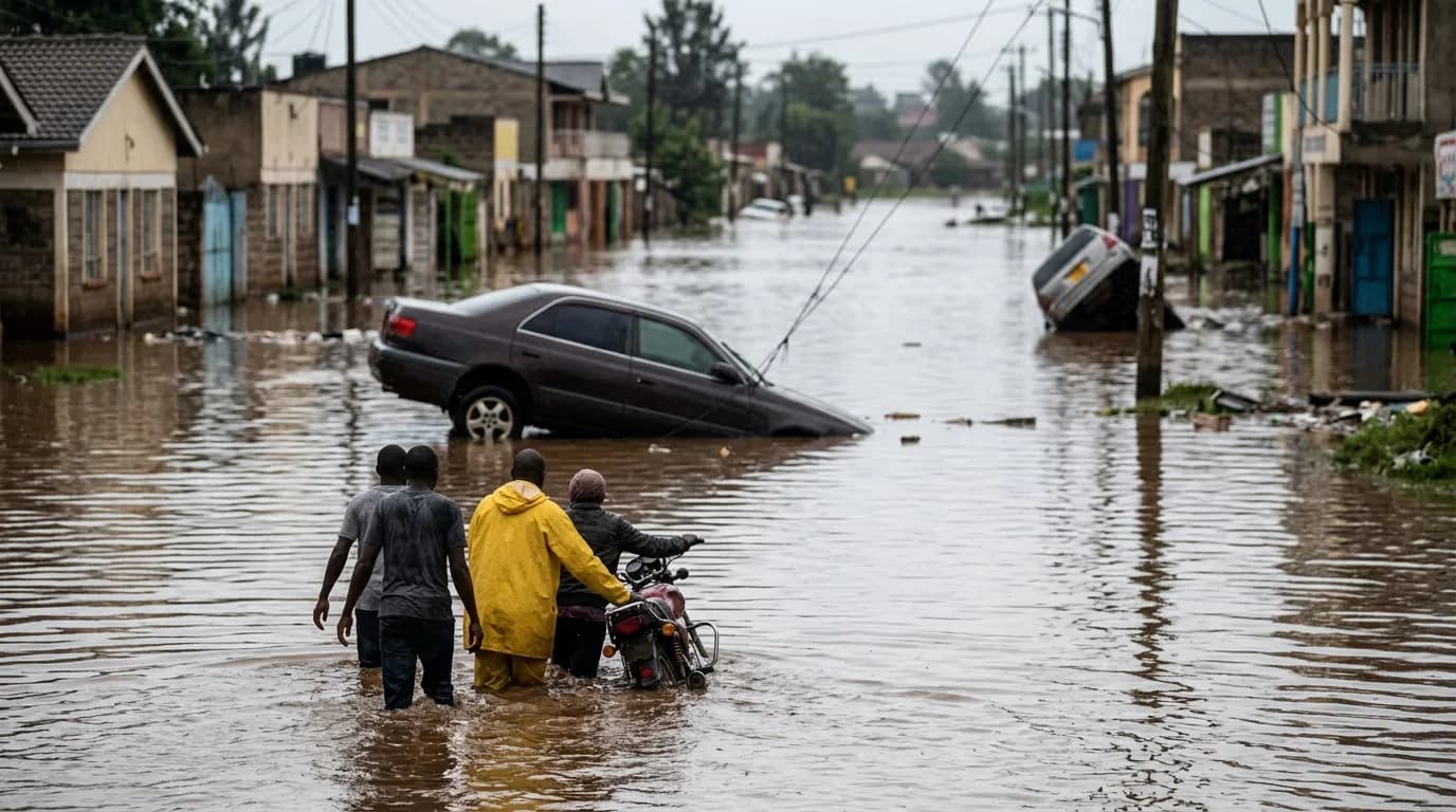
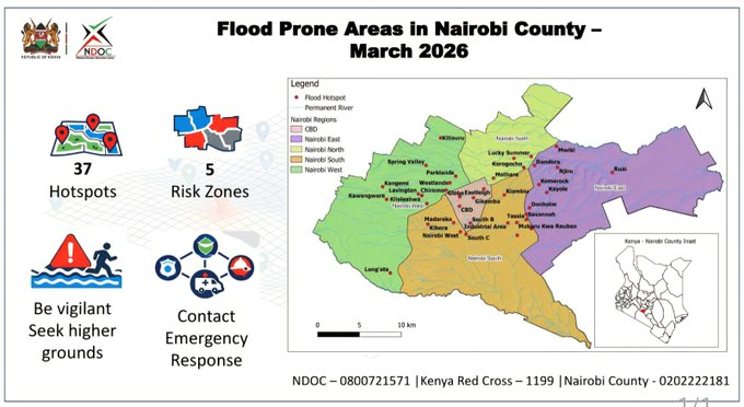
A mapping exercise conducted under the Nairobi Rivers Regeneration Programme has named the 37 neighborhoods sitting in the path of major rivers and at risk of floods.
In Nairobi North, Mathare, Korogocho, and Lucky Summer border the Mathare River directly. Some of these areas are characterized by dense settlements where riverbanks and residential plots are indistinguishable.
For Nairobi East, the at-risk areas include Kiambiu, Dandora, Kariobangi, Kayole, Komarock, Njiru, Ruai, Mwiki, Donholm, Savannah, Tassia, and Fedha.
The Central Business District, Globe, Gikomba, Eastleigh, and the Industrial Area sit along the Nairobi River corridor within Nairobi Central. The Nairobi South region has Kilimani, Kibera, South C, South B, Mukuru Kwa Reuben, and Kwa Njenga, which lie along the Ngong River corridor.
Nairobi West has some of the city’s more affluent neighborhoods. The areas at risk include Madaraka, Lang’ata, Kawangware, Kangemi, Lavington, Westlands, Parklands, Kitisuru, Spring Valley, Kileleshwa, and Chiromo.
| Region | Flood-Risk Neighbourhoods | River Corridor |
|---|---|---|
| Nairobi North | Mathare, Korogocho, Lucky Summer | Mathare River |
| Nairobi East | Kiambiu, Dandora, Kariobangi, Kayole, Komarock, Njiru, Ruai, Mwiki, Donholm, Savannah, Tassia, Fedha | Nairobi River & tributaries (downstream) |
| Nairobi Central | CBD, Globe, Gikomba, Eastleigh, Industrial Area | Nairobi River (through city centre) |
| Nairobi West | Madaraka, Nairobi West, Lang’ata, Kawangware, Kangemi, Lavington, Westlands, Parklands, Kitisuru, Spring Valley, Kileleshwa, Chiromo | Nairobi River (upstream & midstream) |
| Nairobi South | Kilimani, Kibera, South C, South B, Mukuru Kwa Reuben, Kwa Njenga | Ngong River |
Evidently, floodwaters do not spare the city’s commercial heart, as witnessed on Kirinyaga Road, where extensive property damage occurred, and lives were lost.

The flood risk cuts across income lines, placing informal settlements like Mathare and Kibera on the same list as middle-class and affluent areas, including Lavington, Westlands, Parklands, and Spring Valley.
For many, the crisis is no longer a threat but a reality. Students at the University of Nairobi’s (UoN) Chiromo hostels dealt with flooding after Saturday night’s downpour.
University of Nairobi (UoN) Hall 20 hostels flooded following heavy rains on Saturday night. pic.twitter.com/W1IOzIUWh7
— Nyakundi Report (@NyakundiReport) March 14, 2026
Kenya Met warns that rainfall intensity may fluctuate, but the risk remains elevated through the month. After the recent floods, Nairobi has officially recorded the highest death toll in Kenya, with 33 lives lost as of March 14, 2026.
Residents living near riparian areas and in low-lying zones on this list are urged to move to higher ground during heavy rainfall and not to wait for water to reach their doors.



Comments
No comments yet. Be the first to share your thoughts.