

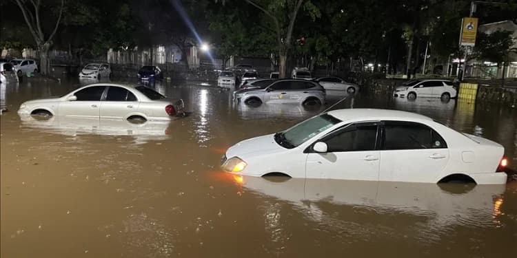
The Kenya Red Cross and Nairobi County Government have mapped about 227 flood hotspots ahead of the predicted October to December El Niño rains.
Governor Johnson Sakaja on Monday, August 17, led a multi-agency response to prevent a repeat of the devastating flooding seen in previous rainy seasons.
Of the 227 hotspots identified, 189 have been classified as high priority while 22 are considered medium priority.
Sakaja said forecasts of above-normal rainfall, heavy downpours and strong winds required early intervention to protect lives and property across the capital.
“It’s not a new thing. We’ve been working together to be very proactive this time and make sure that we protect lives and safeguard the property of the people of Nairobi,” Sakaja said.
“That is work that we intend to expedite so that these areas where we know always have flooding, always have challenges such as the winds are addressed.”
Nairobi County To Improve Drainage Systems
According to the technical team, an assessment found mudslides, blocked drainage systems and improper waste disposal among the leading causes of flooding, accounting for 45 percent of affected areas.
The county has established five subcommittees focusing on infrastructure and drainage, rescue and evacuation, shelter and relief, security and transport, and communication and early warning.
More than 2,000 personnel are expected to be deployed alongside heavy machinery to clear drainage systems, remove waste and mud, open blocked culverts and desilt rivers.
The Kenya Red Cross has since identified 18 areas at high risk of flooding and recommended urgent drainage clearance, culvert replacement, and river desilting, particularly in Dagoretti North, Mathare, Embakasi North, Embakasi South and Makadara.
Kenya Red Cross Secretary General Ahmed Idris said the measures were intended to minimize the impact of flooding and improve coordination between government agencies and humanitarian organizations.
Residents living along waterways and riverbanks have also been issued 14-day notices to relocate to safer areas.
The county said it would provide information on emergency communication channels through which residents can reach its response teams and the Kenya Red Cross during emergencies.
Health teams will also conduct disease surveillance and coordinate health and WASH interventions in flood-affected areas.
Kenya Met Warns of El Niño
The Kenya Meteorological Department has forecast an 81 percent probability of exceptionally heavy El Niño rains, with a 97 percent likelihood that the rains will continue through January 2027.
According to the weatherman, counties in the Coastal, Lake Basin, Rift Valley and North Eastern regions were among those facing the highest levels of vulnerability.
Nairobi, Mombasa and Kisumu were also identified as high-risk urban centres, with potential threats including flooding, drainage blockages, infrastructure strain and service disruptions.
In the Coast Region, Tana River, Kilifi, Lamu, Mombasa and Kwale are at risk of flooding, storm surges, coastal erosion and infrastructure damage, with some residents facing possible displacement.
Areas in the Lake Basin, including Kisumu, Busia, Siaya, Homa Bay and Migori, are expected to face flooding, landslides, disease outbreaks and displacement.
In the Rift Valley, Turkana, Baringo, West Pokot and Narok face risks including drought, flash floods, landslides, livestock losses and food insecurity.
Garissa, Wajir, and Mandera in the Northeastern Region also face drought, water scarcity, livestock losses, poor pasture, and food insecurity.
Follow our WhatsApp Channel and X Account for real-time news updates.


Comments
No comments yet. Be the first to share your thoughts.